Dapatkan Verifikasi & Perbarui Profil
Profil yang diklaim akan muncul di bagian atas hasil pencarian. Dapatkan verifikasi sekarang, hanya butuh beberapa menit.
Mengunjungi
Laporan
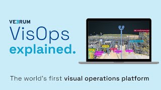
A visual operations platform facilitates the management and collaboration of industrial data by transforming it into an interactive 3D environment, enabling teams to visualize and analyze asset information remotely. Key features include real-time collaboration, geolocation of visual data, and integration with various data sets, addressing challenges such as reducing site visits, enhancing decision-making accuracy, and improving project alignment for industries like oil and gas, mining, and construction.
VEERUM dapat ditemukan di Mapping & Geographic Information Platform (GIS) kategori.
Produk yang paling mirip dengan VEERUM adalah:
Tangkapan layar
Belum ada tangkapan layar yang diunggah. Apakah Anda pemilik bisnis ini?
Unggah tangkapan layar.Video YouTube
Video dari saluran YouTube resmi
(20 videos)


Rincian
LinkedIn:
Mengunjungi
YouTube:
Mengunjungi
Facebook:
Mengunjungi
X:
Mengunjungi
Tahun Berdiri:
2014
Harga:
$0/mo
Jenis Konsumen:
B2B
Ulasan
–
0 ulasan
5
–
4
–
3
–
2
–
1
–
Fitur Utama VEERUM
Manfaat VEERUM
Siapa yang harus menggunakan VEERUM?
Lencana
Tingkatkan otoritas SaaS Anda dengan salah satu lencana kami
Alternatif VEERUM
Taskade Dipromosikan
A comprehensive digital platform designed to facilitate the creation, automat...
Barrows, Kunze and Hessel Enterprise Dipromosikan
A comprehensive digital platform designed to facilitate the creation, automat...
Aetos
This platform enhances operational efficiency by providing a comprehensive vi...
Optelos
The Visual Inspection Data Management Platform leverages Computer Vision AI t...
Hopara
This platform enables you to build a digital representation of your operation...
Flow Immersive
This innovative platform transforms complex datasets into immersive, interact...
Eye-bot
A remote asset visualization platform blends autonomous drone flights, 3D sca...
Birdi
A collaborative geospatial platform enables teams to seamlessly manage, visua...
Jelajahi lebih lanjut dalam kategori ini:
Teknologi yang Digunakan
Matomo
Awesome Font
WordPress REST API
Gravity Forms
Google Tag Manager
Cloudways
CDNJS
Tailwind
Hubspot
Cookiebot
HTML5
WordPress
Wistia
Cloudflare
Wix Content Delivery Network (CDN)
* Google berupaya keras untuk menyediakan informasi akurat dan terkini tentang sumber daya web yang tidak aman, tetapi tidak dapat menjamin kelengkapan atau hasil bebas kesalahan.
** Beberapa atau semua bagian halaman ini mungkin dihasilkan oleh AI, jadi harap verifikasi informasi penting apa pun secara independen.
Baru-baru ini Diklaim
Platform Penelitian Hukum Bertenaga AI
Platform Manajemen Acara & Tiket
Perangkat Lunak Penjadwalan Janji Temu
Perangkat Lunak Analisis & Visualisasi Data
Manajemen & Optimasi Web Hosting
Platform Otomasi Pemasaran
Alat Perencanaan & Penganggaran Keuangan
Manajemen Properti Sewa
Platform E-Government & Transformasi Digital
Pusat Kebugaran, Olahraga, dan Kebugaran
Baru Ditambahkan
Ekklesiasys
Perangkat Lunak Manajemen Gereja
Venzallo
Perangkat Lunak Penjadwalan Janji Temu
A6A
Perangkat Lunak Analitik Prediktif
ClearlyRated
Perangkat Lunak Umpan Balik & Survei Pelanggan
Yoo
Perangkat Lunak Penjadwalan Janji Temu
DelayOFF
Otomasi Industri
Redoubt Systems
Obrolan & Pesan Tim
Inpromptify
Alat Penyaringan Resume Bertenaga AI
EazyStats
Perangkat Lunak Analisis Produk
XPay
Bursa Mata Uang Kripto
10 Kategori Terpopuler Bulan Ini
1.
Perangkat Lunak Otomasi Penjualan
+856
Jumlah produk SaaS baru yang ditambahkan ke kategori ini dalam 30 hari terakhir.
2.
Platform Manajemen Blockchain & NFT
+592
Jumlah produk SaaS baru yang ditambahkan ke kategori ini dalam 30 hari terakhir.
3.
Alat Manajemen Dokumen & Tanda Tangan Elektronik
+522
Jumlah produk SaaS baru yang ditambahkan ke kategori ini dalam 30 hari terakhir.
4.
Avatar Virtual & Asisten Digital Bertenaga AI
+497
Jumlah produk SaaS baru yang ditambahkan ke kategori ini dalam 30 hari terakhir.
5.
Alat Keamanan & Kepatuhan Cloud
+493
Jumlah produk SaaS baru yang ditambahkan ke kategori ini dalam 30 hari terakhir.
6.
Alat Penyaringan Resume Bertenaga AI
+489
Jumlah produk SaaS baru yang ditambahkan ke kategori ini dalam 30 hari terakhir.
7.
Diagnosis & Analisis Kesehatan Bertenaga AI
+445
Jumlah produk SaaS baru yang ditambahkan ke kategori ini dalam 30 hari terakhir.
8.
Platform Penelitian Hukum Bertenaga AI
+433
Jumlah produk SaaS baru yang ditambahkan ke kategori ini dalam 30 hari terakhir.
9.
Platform Pembelajaran dan Pendidikan
+426
Jumlah produk SaaS baru yang ditambahkan ke kategori ini dalam 30 hari terakhir.
10.
Perangkat Lunak Manajemen Armada
+422
Jumlah produk SaaS baru yang ditambahkan ke kategori ini dalam 30 hari terakhir.
Statistik Browser SaaS
Ditambahkan dalam 30 Hari Terakhir
+21,811
Jumlah produk SaaS baru yang ditemukan dan ditambahkan ke basis data kami dalam 30 hari terakhir.
SaaS Aktif
468,001
Jumlah total produk SaaS yang diterbitkan dan aktif yang saat ini diindeks di mesin pencari kami.
Jumlah Total dalam Basis Data
1,296,182
Jumlah total semua produk SaaS dalam basis data kami, termasuk entri yang belum dipublikasikan dan yang telah dihentikan.
Gabung SaaS Browser secara Gratis
Gunakan semua filter lanjutan secara gratis.
Kelola daftar SaaS Anda
Buat peringatan gratis untuk SaaS baru
Disponsori
Xtensio
Platform Pemasaran Konten
Fish Audio
Kloning Suara & Teks ke Ucapan SaaS
Oh Dear
Pemantauan Situs Web, Waktu Aktif & Kinerja
Harpoon
Alat Perencanaan & Penganggaran Keuangan
Mailshake
Platform Otomasi Pemasaran
Receipt Bot
Pemrosesan Dokumen Bertenaga AI
SendShort
Alat Pengeditan Video & Animasi Bertenaga AI
Cloud Campaign
Manajemen & Penjadwalan Media Sosial
Empire Flippers
Broker dan Pasar
SimpleBackups
Penyimpanan Cloud, Pencadangan & Berbagi File
Jangan sampai ketinggalan, jadilah yang pertama tahu!
Produk SaaS baru diluncurkan setiap hari, 21,811 ditambahkan hanya dalam 30 hari terakhir. Tetaplah terinformasi, dan jadilah yang pertama mengetahui kapan SaaS baru yang sesuai dengan kueri pencarian Anda ditemukan oleh SaaS Browser.
Masuk untuk mengatur notifikasi email untuk SaaS baru yang sesuai dengan pencarian Anda.
Masuk untuk Membuat Notifikasi
Jelajahi alat serupa
Lihat semua →