Dot3D
건축 설계 및 제도 소프트웨어This three-dimensional scanning application provides precise control over accuracy, enabling detailed and extensive capture of large-scale scenes such as buildings, roadways, and infrastructure. Its key features include automatic optimization algorithms for post-processing, seamless integration with high-precision GNSS devices for geo-referencing, support for adding coded targets and reference measurements to improve accuracy, and the ability to handle virtually unlimited scene sizes with rapid local processing and compatibility with desktop data editing—making it ideal for professionals in architecture, surveying, construction, and engineering seeking efficient, reliable, and scalable 3D data acquisition and analysis.
Dot3D은 다음에서 찾을 수 있습니다. Architectural Design & Drafting Software 카테고리.
Dot3D과 가장 유사한 제품은 다음과 같습니다.
스크린샷
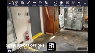
아직 업로드된 스크린샷이 없습니다. 이 사업체의 소유주이신가요?
스크린샷을 업로드하세요.유튜브 동영상
공식 유튜브 채널의 영상들
(2 videos)

세부
LinkedIn:
방문하다
YouTube:
방문하다
Facebook:
방문하다
X:
방문하다
Instagram:
방문하다
설립 연도:
2012
가격:
$0-$999/mo
소비자 유형:
B2B
Dot3D 주요 특징
배지
당사 배지 중 하나로 SaaS 권한을 높이세요
Dot3D 대안
Contractor Foreman 홍보됨
This comprehensive construction management platform streamlines the coordinat...
Watsica-Flatley Ultimate 홍보됨
This comprehensive construction management platform streamlines the coordinat...
Pythagoras
This software suite provides comprehensive tools for surveying, mapping, cons...
3Dsurvey
This comprehensive software solution specializes in photogrammetry, mapping, ...
Carlson
This comprehensive land surveying and civil engineering software suite offers...
NUBIGON
This software facilitates the visualization, analysis, and presentation of co...
Undet
This software suite offers advanced tools for converting, visualizing, and an...
Ajile
This advanced 3D imaging and measurement system leverages high-resolution, fu...
RecFusion
This system enables real-time 3D digitization and modeling using RGB-D sensor...
SkyeBrowse
This innovative software transforms video footage into detailed 3D models, en...
이 카테고리에서 더 많은 내용을 살펴보세요:
사용된 기술
Squarespace
reCAPTCHA
MailChimp
Zoho
Adobe Fonts
Google Tag Manager
Tailwind
HTML5
Angular
WordPress
Wix Content Delivery Network (CDN)
제휴 프로그램
제휴 프로그램:
제휴 프로그램에 참여하세요
* Google은 안전하지 않은 웹 리소스에 대한 정확하고 최신 정보를 제공하기 위해 노력하지만 완전성이나 오류 없는 결과를 보장할 수 없습니다.
** 이 페이지의 일부 또는 전체 내용은 AI에서 생성되었을 수 있으므로 중요한 정보는 독립적으로 확인하십시오.
최근 청구됨
재무 계획 및 예산 도구
SEO 도구
웹 호스팅 관리 및 최적화
콘텐츠 마케팅 플랫폼
아마존 FBA 도구
챗봇 및 대화형 마케팅 도구
시간 추적 및 생산성 소프트웨어
영업 자동화 소프트웨어
중개 및 마켓플레이스
레스토랑 POS 및 관리 시스템
최근 추가됨
Converterer
파일 변환 도구
MarketPulse
예측 분석 소프트웨어
Kulode
회계 소프트웨어
Uppinger
웹사이트 모니터링, 가동 시간 및 성능
VivaLynx
가정 건강 관리 소프트웨어
Loss Run Pro
보험 대리점 관리
VocalMeeting
가상 교실 소프트웨어
Hischool
학습 및 교육 플랫폼
TaskAI
작업 관리 및 할 일 목록 앱
Digital Voting System
선거 관리 소프트웨어
이달의 인기 카테고리 10선
1.
영업 자동화 소프트웨어
+856
지난 30일 동안 이 카테고리에 추가된 신규 SaaS 제품 수.
2.
블록체인 및 NFT 관리 플랫폼
+592
지난 30일 동안 이 카테고리에 추가된 신규 SaaS 제품 수.
3.
문서 관리 및 전자 서명 도구
+522
지난 30일 동안 이 카테고리에 추가된 신규 SaaS 제품 수.
4.
AI 기반 가상 아바타 및 디지털 비서
+497
지난 30일 동안 이 카테고리에 추가된 신규 SaaS 제품 수.
5.
클라우드 보안 및 규정 준수 도구
+493
지난 30일 동안 이 카테고리에 추가된 신규 SaaS 제품 수.
6.
AI 기반 이력서 검토 도구
+489
지난 30일 동안 이 카테고리에 추가된 신규 SaaS 제품 수.
7.
AI 기반 진단 및 의료 분석
+445
지난 30일 동안 이 카테고리에 추가된 신규 SaaS 제품 수.
8.
AI 기반 법률 연구 플랫폼
+433
지난 30일 동안 이 카테고리에 추가된 신규 SaaS 제품 수.
9.
학습 및 교육 플랫폼
+426
지난 30일 동안 이 카테고리에 추가된 신규 SaaS 제품 수.
10.
차량 관리 소프트웨어
+422
지난 30일 동안 이 카테고리에 추가된 신규 SaaS 제품 수.
SaaS 브라우저 통계
지난 30일 동안 추가됨
+21,811
지난 30일 동안 당사 데이터베이스에 새로 추가된 SaaS 제품의 수입니다.
액티브 SaaS
468,001
현재 당사 검색 엔진에 색인된 게시 및 활성화된 SaaS 제품의 총 개수입니다.
데이터베이스의 총계
1,296,182
데이터베이스에 등록된 모든 SaaS 제품의 총 개수이며, 여기에는 미등록 및 단종된 제품도 포함됩니다.
스폰서
BigMailer
이메일 마케팅 소프트웨어
plusvibe
이메일 아웃리치 및 콜드 이메일 도구
CallHippo
챗봇 및 대화형 마케팅 도구
ClearCRM
CRM(고객 관계 관리)
DeeVid AI
AI 기반 광고 크리에이티브 및 비디오 생성
Unicorn Platform
웹사이트 빌더
FlipperForce
토지 투자 및 토지 재개발 소프트웨어
Sniply
SMS 및 WhatsApp 마케팅 도구
Click Analytic
인플루언서 마케팅 및 아웃리치 도구
Oh Dear
웹사이트 모니터링, 가동 시간 및 성능
놓치지 마세요, 누구보다 먼저 소식을 접하세요!
매일 새로운 SaaS 제품이 출시되고 있으며, 지난 30일 동안에만 21,811개의 제품이 추가되었습니다. SaaS Browser를 통해 검색어와 일치하는 새로운 SaaS 제품이 발견되면 가장 먼저 알림을 받으세요.
검색어와 일치하는 새로운 SaaS에 대한 이메일 알림을 설정하려면 로그인하세요.
로그인하여 알림 만들기
유사한 도구 살펴보기
모두 보기 →