Pradžia › Visos kategorijos › Nekilnojamojo turto virtuali ekskursija ir 3D žemėlapiai › Virtual Surveyor
Virtual Surveyor
Nekilnojamojo turto virtuali ekskursija ir 3D žemėlapiai
Gaukite patvirtinimą ir atnaujinkite profilį
Patvirtinti profiliai rodomi paieškos rezultatų viršuje. Gaukite patvirtinimą dabar, tai užtruks vos kelias minutes.
Apsilankymas
Pranešti
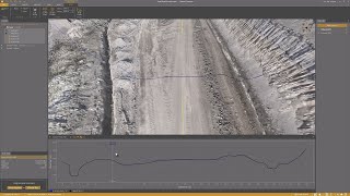
Virtual Surveyor offers advanced drone surveying software designed to improve efficiency in topographic surveying, mining, construction earthworks, and stockpile inventory management.
Features like the Terrain Creator and Virtual Surveyor apps, users can seamlessly transform drone data into actionable insights, ensuring precise reporting and streamlined workflows.
Virtual Surveyor galima rasti Real Estate Virtual Tour & 3D Mapping kategorijos.
Panašiausi į Virtual Surveyor produktai yra šie:
Ekrano kopijos
Dar neįkelta jokių ekrano kopijų. Ar esate šios įmonės savininkas?
Įkelti ekrano kopijas.“„YouTube” vaizdo įrašai”
Vaizdo įrašai iš oficialaus „YouTube” kanalo
(20 videos)


![Balancing Cut and Fill [in PEAK]](https://i.ytimg.com/vi/bfoh-Lw3f5k/mqdefault.jpg)


![Planimetric Surveying [Fast and Simple]](https://i.ytimg.com/vi/bYudnDPf1d0/mqdefault.jpg)
![From Drone Photos to Topographic Surveys [EASY]](https://i.ytimg.com/vi/C4iywCyrctY/mqdefault.jpg)
![Contour lines at bare earth [with Zenmuse L1]](https://i.ytimg.com/vi/ClTtmWF45vY/mqdefault.jpg)
![Stockpile Inventory [with DRONES]](https://i.ytimg.com/vi/JTwOeov5AGI/mqdefault.jpg)
![Surveying curb and gutter [with DRONES]](https://i.ytimg.com/vi/8BEKcYrSnhc/mqdefault.jpg)
![Construction Site Earthworks Monitoring [DIRT]](https://i.ytimg.com/vi/j_R4xs7jJHI/mqdefault.jpg)


Išsami informacija
LinkedIn:
Apsilankymas
YouTube:
Apsilankymas
Instagram:
Apsilankymas
Įkūrimo metai:
2015
Kainodara:
€0-€21/mo
Vartotojo tipas:
B2B
Atsiliepimai
–
0 atsiliepimai
5
–
4
–
3
–
2
–
1
–
Virtual Surveyor Pagrindinės savybės
Virtual Surveyor Privalumai
Kas turėtų naudoti Virtual Surveyor?
Ženkleliai
Padidinkite savo SaaS autoritetą su vienu iš mūsų ženklelių
Virtual Surveyor alternatyvos
Viralsweep Paaukštintas
Viralsweep is a comprehensive viral marketing platform designed to create and...
Pythagoras
This software suite provides comprehensive tools for surveying, mapping, cons...
Drone Surveying
Drone Surveying offers precise aerial surveys for the house building sector, ...
PocketSurvey
Discover innovative building surveying software and mobile apps designed to e...
Civil Tracker
Civil Tracker offers innovative drone mapping software designed to simplify m...
Seiler GeoDrones
This platform offers comprehensive drone solutions, including advanced aerial...
ESurveying Softech
ESurveying Softech offers a range of online tools for infrastructural enginee...
3Dsurvey
This comprehensive software solution specializes in photogrammetry, mapping, ...
Carlson
This comprehensive land surveying and civil engineering software suite offers...
Naršykite daugiau šioje kategorijoje:
Naudotos technologijos
html5shiv
Lightbox2
reCAPTCHA
Freshdesk
Awesome Font
Google Fonts
Google Tag Manager
Animate.css
Freshchat (Freshdesk Messaging)
FontAwesome
CDNJS
CookieConsent by Osano
ASP.NET
Ruby on Rails
HTML5
Wistia
Cloudflare
Wix Content Delivery Network (CDN)
Peržiūrėti visas technologijas
Partnerių programa
Partnerių programa:
Prisijunkite prie partnerių programos
* „Google“ siekia pateikti tikslią ir naujausią informaciją apie nesaugius žiniatinklio išteklius, tačiau negali garantuoti išsamumo ar rezultatų be klaidų.
** Kai kurios arba visos šio puslapio dalys gali būti sugeneruotos dirbtinio intelekto, todėl bet kokią svarbią informaciją patikrinkite atskirai.
Pradžia › Visos kategorijos › Nekilnojamojo turto virtuali ekskursija ir 3D žemėlapiai › Virtual Surveyor
Neseniai pareikštas
Dokumentų valdymo ir elektroninio parašo įrankiai
Pasiūlymų ir sutarčių valdymas
CRM (klientų ryšių valdymas)
Susitikimų planavimo programinė įranga
Saugumo informacijos ir įvykių valdymas (SIEM)
Programinės įrangos testavimas ir kokybės užtikrinimas
Verslo analitika ir verslo analitika
Atsinaujinančios energijos stebėsena ir analizė
Transporto valdymo sistemos (TMS)
Kokybės vadybos sistemos (KVS)
Neseniai pridėta
SmartTenant
Nuomojamo turto valdymas
Anadanthy
Susitikimų planavimo programinė įranga
Checkfirst
Interviu planavimo programinė įranga
Nondit
Klientų atsiliepimų ir apklausų programinė įranga
Rivera
Nekilnojamojo turto CRM ir potencialių klientų valdymas
Apture
Dirbtiniu intelektu paremti gyvenimo aprašymų atrankos įrankiai
Form Duct
Formų kūrimo priemonės ir internetinių apklausų įrankiai
OreNeda
Verslo analitika ir verslo analitika
CoraFood
Maisto užsakymas ir pristatymas internetu
Tensor Compliance
SOC 2 ir atitikties automatizavimas
10 populiariausių kategorijų šį mėnesį
1.
Akcijų prekybos ir tarpininkavimo platformos
+759
Naujų SaaS produktų, pridėtų prie šios kategorijos per pastarąsias 30 dienų, skaičius.
2.
Darbo eigos automatizavimas ir RPA
+598
Naujų SaaS produktų, pridėtų prie šios kategorijos per pastarąsias 30 dienų, skaičius.
3.
Dirbtiniu intelektu paremti gyvenimo aprašymų atrankos įrankiai
+385
Naujų SaaS produktų, pridėtų prie šios kategorijos per pastarąsias 30 dienų, skaičius.
4.
Pardavimų automatizavimo programinė įranga
+339
Naujų SaaS produktų, pridėtų prie šios kategorijos per pastarąsias 30 dienų, skaičius.
5.
AutoML platformos
+335
Naujų SaaS produktų, pridėtų prie šios kategorijos per pastarąsias 30 dienų, skaičius.
6.
Mokyklos valdymo programinė įranga
+299
Naujų SaaS produktų, pridėtų prie šios kategorijos per pastarąsias 30 dienų, skaičius.
7.
Finansinio planavimo ir biudžeto sudarymo įrankiai
+286
Naujų SaaS produktų, pridėtų prie šios kategorijos per pastarąsias 30 dienų, skaičius.
8.
Sveikatos ir fizinio pasirengimo stebėjimas
+263
Naujų SaaS produktų, pridėtų prie šios kategorijos per pastarąsias 30 dienų, skaičius.
9.
Dirbtinio intelekto valdomi virtualūs avatarai ir skaitmeniniai asistentai
+262
Naujų SaaS produktų, pridėtų prie šios kategorijos per pastarąsias 30 dienų, skaičius.
10.
PDF redagavimo ir konvertavimo įrankiai
+249
Naujų SaaS produktų, pridėtų prie šios kategorijos per pastarąsias 30 dienų, skaičius.
SaaS naršyklės statistika
Pridėta per pastarąsias 30 dienų
+23,810
Per pastarąsias 30 dienų į mūsų duomenų bazę atrastų ir įtrauktų naujų SaaS produktų skaičius.
Aktyvus SaaS
463,858
Bendras paskelbtų ir aktyvių SaaS produktų, šiuo metu indeksuotų mūsų paieškos sistemoje, skaičius.
Iš viso duomenų bazėje
1,309,358
Bendras visų SaaS produktų skaičius mūsų duomenų bazėje, įskaitant nepublikuotus ir nebenaudojamus įrašus.
Prisijunkite prie SaaS naršyklės nemokamai
Naudokite visus išplėstinius filtrus nemokamai
Tvarkykite savo SaaS sąrašus
Sukurkite nemokamus įspėjimus apie naujus SaaS sprendimus
Remiama
TotePilot
Sandėlio ir atsargų valdymas
Topol
El. pašto rinkodaros programinė įranga
Offorte
Projektų valdymo programinė įranga
Fraud Blocker
Sukčiavimo aptikimas ir prevencija
LatePoint
Susitikimų planavimo programinė įranga
Folderly
El. pašto klientas ir gautųjų valdymas
LinkBoss
Atgalinių nuorodų ir nuorodų kūrimo įrankiai
Keyword.com
Verslo analitika ir verslo analitika
Serpple
Raktinių žodžių tyrimo įrankiai
Xtensio
Kūrybinio valdymo platformos
Nepraleiskite progos, sužinokite pirmieji!
Nauji SaaS produktai pristatomi kasdien, vien per pastarąsias 30 dienų pridėta 23,810. Būkite informuoti ir pirmieji sužinokite, kai SaaS naršyklė aptinka naują SaaS, atitinkantį jūsų paieškos užklausą.
Prisijunkite, kad nustatytumėte el. pašto įspėjimus apie naujus SaaS, atitinkančius jūsų paiešką.
Prisijunkite, kad sukurtumėte įspėjimą
Naršykite panašius įrankius
Naršyti visus →