Virtual Surveyor
Wirtualny spacer po nieruchomościach i mapowanie 3D
Zweryfikuj i zaktualizuj profil
Zgłoszone profile pojawiają się na górze wyników wyszukiwania. Zweryfikuj już teraz – zajmie Ci to tylko kilka minut.
Odwiedzać
Raport
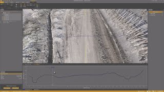
Virtual Surveyor offers advanced drone surveying software designed to improve efficiency in topographic surveying, mining, construction earthworks, and stockpile inventory management.
Features like the Terrain Creator and Virtual Surveyor apps, users can seamlessly transform drone data into actionable insights, ensuring precise reporting and streamlined workflows.
Virtual Surveyor można znaleźć w Real Estate Virtual Tour & 3D Mapping kategorie.
Produkty najbardziej podobne do Virtual Surveyor to:
Zrzuty ekranu
Nie przesłano jeszcze żadnych zrzutów ekranu. Czy jesteś właścicielem tej firmy?
Prześlij zrzuty ekranu.Filmy na YouTube
Filmy z oficjalnego kanału YouTube
(20 videos)


![Balancing Cut and Fill [in PEAK]](https://i.ytimg.com/vi/bfoh-Lw3f5k/mqdefault.jpg)


![Planimetric Surveying [Fast and Simple]](https://i.ytimg.com/vi/bYudnDPf1d0/mqdefault.jpg)
![From Drone Photos to Topographic Surveys [EASY]](https://i.ytimg.com/vi/C4iywCyrctY/mqdefault.jpg)
![Contour lines at bare earth [with Zenmuse L1]](https://i.ytimg.com/vi/ClTtmWF45vY/mqdefault.jpg)
![Stockpile Inventory [with DRONES]](https://i.ytimg.com/vi/JTwOeov5AGI/mqdefault.jpg)
![Surveying curb and gutter [with DRONES]](https://i.ytimg.com/vi/8BEKcYrSnhc/mqdefault.jpg)
![Construction Site Earthworks Monitoring [DIRT]](https://i.ytimg.com/vi/j_R4xs7jJHI/mqdefault.jpg)


Bliższe dane
LinkedIn:
Odwiedzać
YouTube:
Odwiedzać
Instagram:
Odwiedzać
Rok założenia:
2015
Wycena:
€0-€21/mo
Typ konsumenta:
B2B
Recenzje
–
0 recenzje
5
–
4
–
3
–
2
–
1
–
Virtual Surveyor Główne cechy
Virtual Surveyor Korzyści
Kto powinien używać Virtual Surveyor?
Odznaki
Zwiększ autorytet swojego SaaS dzięki jednemu z naszych odznak
Alternatywy Virtual Surveyor
Viralsweep Lansowany
Viralsweep is a comprehensive viral marketing platform designed to create and...
Pythagoras
This software suite provides comprehensive tools for surveying, mapping, cons...
Drone Surveying
Drone Surveying offers precise aerial surveys for the house building sector, ...
PocketSurvey
Discover innovative building surveying software and mobile apps designed to e...
Civil Tracker
Civil Tracker offers innovative drone mapping software designed to simplify m...
Seiler GeoDrones
This platform offers comprehensive drone solutions, including advanced aerial...
ESurveying Softech
ESurveying Softech offers a range of online tools for infrastructural enginee...
3Dsurvey
This comprehensive software solution specializes in photogrammetry, mapping, ...
Carlson
This comprehensive land surveying and civil engineering software suite offers...
Odkryj więcej w tej kategorii:
Zastosowane technologie
html5shiv
Lightbox2
reCAPTCHA
Freshdesk
Awesome Font
Google Fonts
Google Tag Manager
Animate.css
Freshchat (Freshdesk Messaging)
FontAwesome
CDNJS
CookieConsent by Osano
ASP.NET
Ruby on Rails
HTML5
Wistia
Cloudflare
Wix Content Delivery Network (CDN)
Program partnerski
Program partnerski:
Dołącz do programu partnerskiego
* Google dokłada wszelkich starań, aby dostarczać dokładne i aktualne informacje o niebezpiecznych zasobach internetowych, jednak nie może zagwarantować kompletności ani braku błędów w uzyskanych wynikach.
** Część lub całość tej strony może być wygenerowana przez sztuczną inteligencję, dlatego prosimy o niezależne sprawdzenie wszelkich istotnych informacji.
Ostatnio zgłoszone
Business Intelligence i analityka
Oprogramowanie do śledzenia czasu i produktywności
Oprogramowanie do realizacji zamówień i wysyłki
CRM (zarządzanie relacjami z klientami)
Aplikacje do zarządzania zadaniami i listami zadań
Oprogramowanie do realizacji zamówień i wysyłki
Narzędzia dla sprzedawców eBay i Etsy
Narzędzia do współpracy zdalnej
Oprogramowanie księgowe
Zarządzanie wydajnością i oceny pracowników
Ostatnio dodane
Leverdocs
Oprogramowanie księgowe
Cartmata
Systemy punktów sprzedaży (POS)
Tradelle
Narzędzia do automatyzacji dropshippingu
MedSov
Systemy Elektronicznej Dokumentacji Medycznej (EHR)
FameOrbit
Platformy marketingu treści
FlowDock
Zarządzanie magazynem i zapasami
Ecoinch
Oprogramowanie do zarządzania zgodnością
BPWriting
Oprogramowanie do marketingu nieruchomości
conference-ratings
Zarządzanie konferencjami i targami
Acrely
Klonowanie głosu i oprogramowanie SaaS do zamiany tekstu na mowę
10 najpopularniejszych kategorii w tym miesiącu
1.
Platformy do obrotu akcjami i brokerskie
+759
Liczba nowych produktów SaaS dodanych do tej kategorii w ciągu ostatnich 30 dni.
2.
Automatyzacja przepływu pracy i RPA
+598
Liczba nowych produktów SaaS dodanych do tej kategorii w ciągu ostatnich 30 dni.
3.
Narzędzia do przeszukiwania CV oparte na sztucznej inteligencji
+385
Liczba nowych produktów SaaS dodanych do tej kategorii w ciągu ostatnich 30 dni.
4.
Oprogramowanie do automatyzacji sprzedaży
+339
Liczba nowych produktów SaaS dodanych do tej kategorii w ciągu ostatnich 30 dni.
5.
Platformy AutoML
+335
Liczba nowych produktów SaaS dodanych do tej kategorii w ciągu ostatnich 30 dni.
6.
Oprogramowanie do zarządzania szkołą
+299
Liczba nowych produktów SaaS dodanych do tej kategorii w ciągu ostatnich 30 dni.
7.
Narzędzia do planowania finansowego i budżetowania
+286
Liczba nowych produktów SaaS dodanych do tej kategorii w ciągu ostatnich 30 dni.
8.
Monitorowanie zdrowia i sprawności fizycznej
+263
Liczba nowych produktów SaaS dodanych do tej kategorii w ciągu ostatnich 30 dni.
9.
Wirtualne awatary i asystenci cyfrowi z obsługą sztucznej inteligencji
+262
Liczba nowych produktów SaaS dodanych do tej kategorii w ciągu ostatnich 30 dni.
10.
Narzędzia do edycji i konwersji plików PDF
+249
Liczba nowych produktów SaaS dodanych do tej kategorii w ciągu ostatnich 30 dni.
Statystyki przeglądarki SaaS
Dodano w ciągu ostatnich 30 dni
+23,810
Liczba nowych produktów SaaS odkrytych i dodanych do naszej bazy danych w ciągu ostatnich 30 dni.
Aktywne oprogramowanie jako usługa (SaaS)
463,858
Łączna liczba opublikowanych i aktywnych produktów SaaS aktualnie indeksowanych w naszej wyszukiwarce.
Razem w bazie danych
1,309,358
Całkowita liczba wszystkich produktów SaaS w naszej bazie danych, wliczając w to wpisy nieopublikowane i wycofane.
Dołącz do przeglądarki SaaS za darmo
Korzystaj ze wszystkich zaawansowanych filtrów za darmo
Zarządzaj swoimi ofertami SaaS
Twórz bezpłatne alerty dla nowych usług SaaS
Sponsorowane
Mailmodo
Oprogramowanie do marketingu e-mailowego
TekMatix
Platformy automatyzacji marketingu
RankIQ
Narzędzia SEO
Clockify
Oprogramowanie do śledzenia czasu i produktywności
Contractor Foreman
Narzędzia do zarządzania projektami budowlanymi
Taskade
Kreatory aplikacji bez kodu oparte na sztucznej inteligencji
Snaptually
Wirtualne awatary i asystenci cyfrowi z obsługą sztucznej inteligencji
MailViewr
Platformy automatyzacji marketingu
iFax
Oprogramowanie do faksowania online
Pristan.chat
Platformy API i Backend-as-a-Service
Nie przegap, bądź pierwszy, który się dowie!
Nowe produkty SaaS pojawiają się każdego dnia – w ciągu ostatnich 30 dni dodano ich 23,810. Bądź na bieżąco i jako pierwszy dowiaduj się o nowych produktach SaaS odpowiadających Twojemu zapytaniu, które zostaną odkryte przez przeglądarkę SaaS.
Zaloguj się, aby ustawić powiadomienia e-mail dla nowych produktów SaaS pasujących do Twojego wyszukiwania.
Zaloguj się, aby utworzyć alert
Przeglądaj podobne narzędzia
Przeglądaj wszystko →