Doğrulanın ve Profilinizi Güncelleyin
Talep edilen profiller arama sonuçlarının en üstünde yer alır. Hemen doğrula, sadece birkaç dakikanı alır.
Ziyaret etmek
Rapor
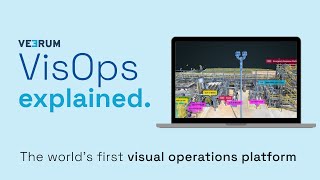
A visual operations platform facilitates the management and collaboration of industrial data by transforming it into an interactive 3D environment, enabling teams to visualize and analyze asset information remotely. Key features include real-time collaboration, geolocation of visual data, and integration with various data sets, addressing challenges such as reducing site visits, enhancing decision-making accuracy, and improving project alignment for industries like oil and gas, mining, and construction.
VEERUM şurada bulunabilir: Mapping & Geographic Information Platform (GIS) kategoriler.
VEERUM ürününe en çok benzeyen ürünler şunlardır:
Ekran görüntüleri
Henüz ekran görüntüsü yüklenmedi. Bu işletmenin sahibi siz misiniz?
Ekran görüntülerini yükleyin.YouTube Videoları
Resmi YouTube kanalından videolar
(20 videos)


Detaylar
LinkedIn:
Ziyaret etmek
YouTube:
Ziyaret etmek
Facebook:
Ziyaret etmek
Kuruluş Yılı:
2014
Fiyatlandırma:
$0/mo
Tüketici Tipi:
B2B
VEERUM Ana Özellikler
VEERUM Faydaları
VEERUM'ı kimler kullanmalı?
Rozetler
Rozetlerimizden biriyle SaaS yetkinizi artırın
VEERUM Alternatifleri
Taskade Terfi Edildi
A comprehensive digital platform designed to facilitate the creation, automat...
Aetos
This platform enhances operational efficiency by providing a comprehensive vi...
Optelos
The Visual Inspection Data Management Platform leverages Computer Vision AI t...
Hopara
This platform enables you to build a digital representation of your operation...
Flow Immersive
This innovative platform transforms complex datasets into immersive, interact...
Eye-bot
A remote asset visualization platform blends autonomous drone flights, 3D sca...
Birdi
A collaborative geospatial platform enables teams to seamlessly manage, visua...
Bu kategoride daha fazlasını keşfedin:
Kullanılan Teknolojiler
Matomo
Awesome Font
WordPress REST API
Gravity Forms
Google Tag Manager
Cloudways
CDNJS
Tailwind
Hubspot
Cookiebot
HTML5
WordPress
Wistia
Cloudflare
Wix Content Delivery Network (CDN)
* Google, güvenli olmayan web kaynakları hakkında doğru ve güncel bilgiler sağlamaya çalışır ancak sonuçların eksiksiz veya hatasız olduğunu garanti edemez.
** Bu sayfanın bazı veya tüm bölümleri yapay zeka tarafından oluşturulmuş olabilir, bu nedenle lütfen kritik bilgileri bağımsız olarak doğrulayın.
Son Zamanlarda Talep Edilenler
CRM (Müşteri İlişkileri Yönetimi)
Yapay Zeka Destekli Transkripsiyon ve Altyazı Oluşturma
Yapay Zeka Destekli Özgeçmiş Tarama Araçları
Muhasebe Yazılımı
Sipariş Gerçekleştirme ve Gönderim Yazılımı
Müşteri Geri Bildirimi ve Anket Yazılımı
Chatbot ve Konuşma Pazarlama Araçları
Gider Yönetimi ve Fiş Tarama Uygulamaları
Belge Yönetimi ve eİmza Araçları
İş Zekası ve Analitik
Son Eklenenler
A6A
Tahmin Analitiği Yazılımı
Computer Planet
Yapay Zeka Destekli Tanı ve Sağlık Analizi
Veoora
Çevrimiçi Yemek Siparişi ve Teslimatı
Xpantra
İK Bilgi Sistemleri ve Temel İK Yazılımları
Kprise
Kurumsal LMS ve Eğitim
Assemble
Yüklenici ve Serbest Çalışan Yönetimi
Precious
Yönlendirme ve Sadakat Programı Yazılımı
Lesson Plan HQ
Sınav ve Değerlendirme Yazılımı
Lemma
Sağlık CRM'i
Spear
Etkileyici Pazarlama ve Tanıtım Araçları
Bu Ayın En İyi 10 Kategorisi
1.
Satış Otomasyon Yazılımı
+856
Son 30 günde bu kategoriye eklenen yeni SaaS ürünlerinin sayısı.
2.
Blockchain ve NFT Yönetim Platformları
+592
Son 30 günde bu kategoriye eklenen yeni SaaS ürünlerinin sayısı.
3.
Belge Yönetimi ve eİmza Araçları
+522
Son 30 günde bu kategoriye eklenen yeni SaaS ürünlerinin sayısı.
4.
Yapay Zeka Destekli Sanal Avatarlar ve Dijital Asistanlar
+497
Son 30 günde bu kategoriye eklenen yeni SaaS ürünlerinin sayısı.
5.
Bulut Güvenliği ve Uyumluluk Araçları
+493
Son 30 günde bu kategoriye eklenen yeni SaaS ürünlerinin sayısı.
6.
Yapay Zeka Destekli Özgeçmiş Tarama Araçları
+489
Son 30 günde bu kategoriye eklenen yeni SaaS ürünlerinin sayısı.
7.
Yapay Zeka Destekli Tanı ve Sağlık Analizi
+445
Son 30 günde bu kategoriye eklenen yeni SaaS ürünlerinin sayısı.
8.
Yapay Zeka Destekli Hukuk Araştırma Platformları
+433
Son 30 günde bu kategoriye eklenen yeni SaaS ürünlerinin sayısı.
9.
Öğrenme ve Eğitim Platformları
+426
Son 30 günde bu kategoriye eklenen yeni SaaS ürünlerinin sayısı.
10.
Filo Yönetim Yazılımı
+422
Son 30 günde bu kategoriye eklenen yeni SaaS ürünlerinin sayısı.
SaaS Tarayıcı İstatistikleri
Son 30 Günde Eklenenler
+21,811
Son 30 günde veritabanımıza eklenen yeni SaaS ürünlerinin sayısı.
Aktif SaaS
468,001
Arama motorumuzda şu anda indekslenmiş olan yayınlanmış ve aktif SaaS ürünlerinin toplam sayısı.
Veritabanındaki Toplam
1,296,182
Veritabanımızdaki tüm SaaS ürünlerinin toplam sayısı, yayınlanmamış ve üretimi durdurulmuş ürünler de dahil.
SaaS Browser'a Ücretsiz Katılın
Tüm gelişmiş filtreleri ücretsiz kullanın.
SaaS ürün listelemelerinizi yönetin
Yeni SaaS ürünleri için ücretsiz uyarılar oluşturun.
Sponsorlu
Postwise
Sosyal Medya Yönetimi ve Planlaması
DrawSQL
Veri Analizi ve Görselleştirme Yazılımı
Mailshake
Pazarlama Otomasyon Platformları
Harpoon
Finansal Planlama ve Bütçeleme Araçları
Snov
Satış Otomasyon Yazılımı
Hello Audio
Podcast Barındırma ve Dağıtım Platformları
FlipperForce
Arazi Yatırımı ve Arazi Çevirme Yazılımı
Devi
Potansiyel Müşteri Oluşturma Yazılımı
RankPrompt
Yapay Zeka Destekli Ürün Öneri Motorları
Sertifier
Sertifikasyon, Sınav ve Değerlendirme Hazırlığı
Fırsatı kaçırmayın, ilk siz haberdar olun!
Her gün yeni SaaS ürünleri piyasaya sürülüyor, sadece son 30 günde 21,811 ürün eklendi. Haberdar olun ve SaaS Browser tarafından arama sorgunuza uyan yeni bir SaaS ürünü keşfedildiğinde ilk siz haberdar olun.
Aramanızla eşleşen yeni SaaS için e-posta uyarıları oluşturmak amacıyla giriş yapın.
Uyarı Oluşturmak için Giriş Yap
Benzer araçları keşfedin
Tümünü görüntüle →