احصل على ملفك الشخصي المُتحقق منه وتحديثه
تظهر الملفات الشخصية المُطالب بها في أعلى نتائج البحث. سجّل الآن، لا يستغرق الأمر سوى بضع دقائق.
يزور
تقرير
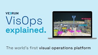
A visual operations platform facilitates the management and collaboration of industrial data by transforming it into an interactive 3D environment, enabling teams to visualize and analyze asset information remotely. Key features include real-time collaboration, geolocation of visual data, and integration with various data sets, addressing challenges such as reducing site visits, enhancing decision-making accuracy, and improving project alignment for industries like oil and gas, mining, and construction.
يمكن العثور على VEERUM في Mapping & Geographic Information Platform (GIS) فئات.
أكثر المنتجات تشابهاً مع VEERUM هي:
لقطات الشاشة
لم يتم تحميل أي لقطات شاشة بعد. هل تملك هذه الشركة؟
تحميل لقطات الشاشة.فيديوهات يوتيوب
مقاطع فيديو من قناة يوتيوب الرسمية
(20 videos)


تفاصيل
LinkedIn:
يزور
YouTube:
يزور
Facebook:
يزور
X:
يزور
سنة التأسيس:
2014
التسعير:
$0/mo
نوع المستهلك:
B2B
الميزات الرئيسية لـ VEERUM
فوائد VEERUM
من يجب أن يستخدم VEERUM؟
الشارات
قم بزيادة سلطة SaaS الخاصة بك باستخدام إحدى شاراتنا
بدائل VEERUM
Taskade تمت الترقية
A comprehensive digital platform designed to facilitate the creation, automat...
Aetos
This platform enhances operational efficiency by providing a comprehensive vi...
Optelos
The Visual Inspection Data Management Platform leverages Computer Vision AI t...
Hopara
This platform enables you to build a digital representation of your operation...
Flow Immersive
This innovative platform transforms complex datasets into immersive, interact...
Eye-bot
A remote asset visualization platform blends autonomous drone flights, 3D sca...
Birdi
A collaborative geospatial platform enables teams to seamlessly manage, visua...
استكشف المزيد في هذه الفئة:
التقنيات المستخدمة
Matomo
Awesome Font
WordPress REST API
Gravity Forms
Google Tag Manager
Cloudways
CDNJS
Tailwind
Hubspot
Cookiebot
HTML5
WordPress
Wistia
Cloudflare
Wix Content Delivery Network (CDN)
* تسعى Google جاهدة لتوفير معلومات دقيقة ومحدثة حول موارد الويب غير الآمنة، ولكنها لا تستطيع ضمان اكتمال النتائج أو خلوها من الأخطاء.
** قد يتم إنشاء بعض أو كل أجزاء هذه الصفحة بواسطة الذكاء الاصطناعي، لذا يرجى التحقق من أي معلومات مهمة بشكل مستقل.
المطالبات الأخيرة
الصور الرمزية الافتراضية والمساعدون الرقميون المدعومون بالذكاء الاصطناعي
الفواتير ومعالجة الدفع
أدوات التخطيط المالي والميزانية
برنامج تحليل البيانات وتصورها
برنامج استطلاع آراء العملاء وملاحظاتهم
إدارة حملات PPC والإعلانات
منصات أتمتة التسويق
الصوت والموسيقى
أدوات فحص السيرة الذاتية المدعومة بالذكاء الاصطناعي
إدارة وجدولة وسائل التواصل الاجتماعي
أضيف مؤخراً
Gleyo
منصات الأسئلة والأجوبة ومجتمعات المعرفة
SaamDigitals
أدوات التسويق عبر الرسائل النصية القصيرة وواتساب
ConnectIQ
برنامج إدارة جهات الاتصال
Gazellia
أتمتة سير العمل وأتمتة العمليات الروبوتية
MurkyNet
واجهة برمجة تطبيقات الرسائل النصية القصيرة
Kitovo
تطبيقات إدارة النفقات ومسح الإيصالات
PIMento
منصات إنترنت الأشياء الصناعية
Olympus
إدارة بطولات الرياضات الإلكترونية
WealthLogix
المستشارون الآليون وإدارة الثروات
Yoo
برنامج جدولة المواعيد
أفضل 10 فئات هذا الشهر
1.
برنامج أتمتة المبيعات
+856
عدد منتجات SaaS الجديدة التي تمت إضافتها إلى هذه الفئة في آخر 30 يومًا.
2.
منصات إدارة البلوكشين والرموز غير القابلة للاستبدال
+592
عدد منتجات SaaS الجديدة التي تمت إضافتها إلى هذه الفئة في آخر 30 يومًا.
3.
أدوات إدارة المستندات والتوقيع الإلكتروني
+522
عدد منتجات SaaS الجديدة التي تمت إضافتها إلى هذه الفئة في آخر 30 يومًا.
4.
الصور الرمزية الافتراضية والمساعدون الرقميون المدعومون بالذكاء الاصطناعي
+497
عدد منتجات SaaS الجديدة التي تمت إضافتها إلى هذه الفئة في آخر 30 يومًا.
5.
أدوات الأمن والامتثال السحابي
+493
عدد منتجات SaaS الجديدة التي تمت إضافتها إلى هذه الفئة في آخر 30 يومًا.
6.
أدوات فحص السيرة الذاتية المدعومة بالذكاء الاصطناعي
+489
عدد منتجات SaaS الجديدة التي تمت إضافتها إلى هذه الفئة في آخر 30 يومًا.
7.
التشخيص وتحليلات الرعاية الصحية المدعومة بالذكاء الاصطناعي
+445
عدد منتجات SaaS الجديدة التي تمت إضافتها إلى هذه الفئة في آخر 30 يومًا.
8.
منصات البحث القانوني المدعومة بالذكاء الاصطناعي
+433
عدد منتجات SaaS الجديدة التي تمت إضافتها إلى هذه الفئة في آخر 30 يومًا.
9.
منصات التعلم والتعليم
+426
عدد منتجات SaaS الجديدة التي تمت إضافتها إلى هذه الفئة في آخر 30 يومًا.
10.
برنامج إدارة الأسطول
+422
عدد منتجات SaaS الجديدة التي تمت إضافتها إلى هذه الفئة في آخر 30 يومًا.
إحصائيات متصفح SaaS
تمت الإضافة خلال الثلاثين يومًا الماضية
+21,811
عدد منتجات SaaS الجديدة التي تم اكتشافها وإضافتها إلى قاعدة بياناتنا في آخر 30 يومًا.
برمجيات كخدمة نشطة
468,001
إجمالي عدد منتجات SaaS المنشورة والنشطة والمفهرسة حاليًا في محرك البحث الخاص بنا.
الإجمالي في قاعدة البيانات
1,296,182
إجمالي عدد جميع منتجات SaaS في قاعدة بياناتنا، بما في ذلك المنتجات غير المنشورة والمتوقفة.
انضم إلى متصفح SaaS مجاناً
استخدم جميع الفلاتر المتقدمة مجاناً
إدارة قوائم برامجك كخدمة (SaaS)
أنشئ تنبيهات مجانية لبرامج SaaS الجديدة
برعاية
Bookly
برنامج جدولة المواعيد
LaunchCut
اختبار A/B وتحسين معدل التحويل
WalletCalcs
أدوات التخطيط المالي والميزانية
Umso
منشئو المواقع الإلكترونية
ProxyCove
واجهة برمجة تطبيقات Web Scraping والوكلاء
Inlinks
أدوات تحسين محركات البحث
Topol
برنامج التسويق عبر البريد الإلكتروني
DashThis
برنامج تحليل البيانات وتصورها
Taggbox
منصات تسويق المحتوى
Offorte
برنامج إدارة المشاريع
لا تفوت الفرصة، كن أول من يعلم!
تُطلق منتجات SaaS جديدة يوميًا، وقد أُضيف 21,811 منتجًا خلال الثلاثين يومًا الماضية فقط. ابقَ على اطلاع، وكن أول من يعلم عند اكتشاف متصفح SaaS لمنتجات SaaS جديدة تُطابق استعلام بحثك.
سجّل الدخول لإعداد تنبيهات بريد إلكتروني لبرامج SaaS الجديدة المطابقة لبحثك.
تسجيل الدخول لإنشاء تنبيه
استكشف أدوات مشابهة
تصفح الكل →