Lassen Sie sich verifizieren und aktualisieren Sie Ihr Profil
Beanspruchte Profile erscheinen ganz oben in den Suchergebnissen. Lassen Sie sich jetzt verifizieren, es dauert nur ein paar Minuten.
Besuchen
Bericht
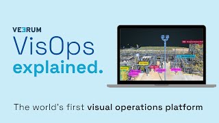
A visual operations platform facilitates the management and collaboration of industrial data by transforming it into an interactive 3D environment, enabling teams to visualize and analyze asset information remotely. Key features include real-time collaboration, geolocation of visual data, and integration with various data sets, addressing challenges such as reducing site visits, enhancing decision-making accuracy, and improving project alignment for industries like oil and gas, mining, and construction.
VEERUM kann gefunden werden in Mapping & Geographic Information Platform (GIS) Kategorien.
Die Produkte, die VEERUM am ähnlichsten sind, sind:
Screenshots
Es wurden noch keine Screenshots hochgeladen. Gehört Ihnen dieses Unternehmen?
Laden Sie Screenshots hoch.YouTube-Videos
Videos vom offiziellen YouTube-Kanal
(20 videos)


Details
LinkedIn:
Besuchen
YouTube:
Besuchen
Facebook:
Besuchen
X:
Besuchen
Gründungsjahr:
2014
Preisgestaltung:
$0/mo
Verbrauchertyp:
B2B
Rezensionen
–
0 Rezensionen
5
–
4
–
3
–
2
–
1
–
VEERUM Hauptfunktionen
VEERUM Vorteile
Wer sollte VEERUM verwenden?
Abzeichen
Steigern Sie Ihre SaaS-Autorität mit einem unserer Abzeichen
VEERUM-Alternativen
Taskade Befördert
A comprehensive digital platform designed to facilitate the creation, automat...
Aetos
This platform enhances operational efficiency by providing a comprehensive vi...
Optelos
The Visual Inspection Data Management Platform leverages Computer Vision AI t...
Hopara
This platform enables you to build a digital representation of your operation...
Flow Immersive
This innovative platform transforms complex datasets into immersive, interact...
Eye-bot
A remote asset visualization platform blends autonomous drone flights, 3D sca...
Birdi
A collaborative geospatial platform enables teams to seamlessly manage, visua...
Entdecken Sie mehr in dieser Kategorie:
Verwendete Technologien
Matomo
Awesome Font
WordPress REST API
Gravity Forms
Google Tag Manager
Cloudways
CDNJS
Tailwind
Hubspot
Cookiebot
HTML5
WordPress
Wistia
Cloudflare
Wix Content Delivery Network (CDN)
* Google ist bestrebt, genaue und aktuelle Informationen zu unsicheren Webressourcen bereitzustellen, kann jedoch keine Vollständigkeit oder fehlerfreie Ergebnisse garantieren.
** Einige oder alle Teile dieser Seite können mithilfe von KI generiert sein. Überprüfen Sie daher alle wichtigen Informationen bitte unabhängig.
Kürzlich beansprucht
Kundenfeedback- und Umfragesoftware
Business Intelligence und Analytik
Schwachstellenanalyse und Penetrationstests
Social Media Management und Planung
POS- und Managementsysteme für Restaurants
KI-gestützte Plattformen für Rechtsrecherche
Chatbot- und Conversational-Marketing-Tools
Plattform für kollektive Intelligenz
KI-gestützte Plattformen für Rechtsrecherche
Kundenfeedback- und Umfragesoftware
Kürzlich hinzugefügt
CarHill Medical
Patiententerminplanung & CRM für Kliniken
TextNeighborly
SMS- und Textnachrichten-API
Surfaced
KI-gestützte Plattformen für Rechtsrecherche
Oxygen
Business Intelligence und Analytik
LeadBox
Software zur Lead-Generierung
Hisaba Kitab
POS- und Managementsysteme für Restaurants
CrestPointFX
DeFi-Plattformen
Graphico
Eingebettete Analysen und Dashboards
OpenClaw
Discord- und Telegram-Community-Tools
Chumchon
DeFi-Plattformen
Top 10 Kategorien diesen Monat
1.
Vertriebsautomatisierungssoftware
+856
Anzahl der in den letzten 30 Tagen in diese Kategorie hinzugefügten neuen SaaS-Produkte.
2.
Blockchain- und NFT-Verwaltungsplattformen
+592
Anzahl der in den letzten 30 Tagen in diese Kategorie hinzugefügten neuen SaaS-Produkte.
3.
Dokumentenmanagement- und eSignatur-Tools
+522
Anzahl der in den letzten 30 Tagen in diese Kategorie hinzugefügten neuen SaaS-Produkte.
4.
KI-gestützte virtuelle Avatare und digitale Assistenten
+497
Anzahl der in den letzten 30 Tagen in diese Kategorie hinzugefügten neuen SaaS-Produkte.
5.
Cloud-Sicherheits- und Compliance-Tools
+493
Anzahl der in den letzten 30 Tagen in diese Kategorie hinzugefügten neuen SaaS-Produkte.
6.
KI-gestützte Tools zur Lebenslaufprüfung
+489
Anzahl der in den letzten 30 Tagen in diese Kategorie hinzugefügten neuen SaaS-Produkte.
7.
KI-gestützte Diagnose und Gesundheitsanalyse
+445
Anzahl der in den letzten 30 Tagen in diese Kategorie hinzugefügten neuen SaaS-Produkte.
8.
KI-gestützte Plattformen für Rechtsrecherche
+433
Anzahl der in den letzten 30 Tagen in diese Kategorie hinzugefügten neuen SaaS-Produkte.
9.
Lern- und Bildungsplattformen
+426
Anzahl der in den letzten 30 Tagen in diese Kategorie hinzugefügten neuen SaaS-Produkte.
10.
Flottenmanagement-Software
+422
Anzahl der in den letzten 30 Tagen in diese Kategorie hinzugefügten neuen SaaS-Produkte.
SaaS-Browserstatistiken
Hinzugefügt in den letzten 30 Tagen
+21,811
Anzahl der neuen SaaS-Produkte, die in den letzten 30 Tagen entdeckt und unserer Datenbank hinzugefügt wurden.
Aktive SaaS
468,001
Gesamtzahl der veröffentlichten und aktiven SaaS-Produkte, die derzeit in unserer Suchmaschine indexiert sind.
Gesamt in der Datenbank
1,296,182
Gesamtzahl aller SaaS-Produkte in unserer Datenbank, einschließlich unveröffentlichter und eingestellter Einträge.
Jetzt kostenlos bei SaaS Browser anmelden
Nutzen Sie alle erweiterten Filter kostenlos
Verwalten Sie Ihre SaaS-Einträge
Erstellen Sie kostenlose Benachrichtigungen für neue SaaS-Lösungen.
Gesponsert
Nuelink
Social Media Management und Planung
REsimpli
CRM und Lead-Management für Immobilien
FullCertified
Vorbereitung auf Zertifizierungen, Prüfungen und Beurteilungen
Buffer
Social Media Management und Planung
Recapture
E-Mail-Marketing-Software
DrawSQL
Datenanalyse- und Visualisierungssoftware
Snov
Vertriebsautomatisierungssoftware
Rewardful
Software für Empfehlungs- und Treueprogramme
G Maps Extractor
Kartierungs- und Geoinformationsplattform (GIS)
Offorte
Projektmanagement-Software
Verpassen Sie nichts, erfahren Sie es als Erster!
Täglich kommen neue SaaS-Produkte auf den Markt, allein in den letzten 30 Tagen kamen 21,811 hinzu. Bleiben Sie informiert und erfahren Sie als Erster, wenn der SaaS-Browser neue SaaS-Produkte entdeckt, die Ihrer Suchanfrage entsprechen.
Melden Sie sich an, um E-Mail-Benachrichtigungen für neue SaaS einzurichten, die Ihrer Suche entsprechen.
Anmelden um Benachrichtigung zu erstellen
Entdecken Sie ähnliche Tools
Alle anzeigen →