Virtual Surveyor
Virtuelle Immobilientour und 3D-Mapping
Lassen Sie sich verifizieren und aktualisieren Sie Ihr Profil
Beanspruchte Profile erscheinen ganz oben in den Suchergebnissen. Lassen Sie sich jetzt verifizieren, es dauert nur ein paar Minuten.
Besuchen
Bericht
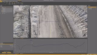
Virtual Surveyor offers advanced drone surveying software designed to improve efficiency in topographic surveying, mining, construction earthworks, and stockpile inventory management.
Features like the Terrain Creator and Virtual Surveyor apps, users can seamlessly transform drone data into actionable insights, ensuring precise reporting and streamlined workflows.
Virtual Surveyor kann gefunden werden in Real Estate Virtual Tour & 3D Mapping Kategorien.
Die Produkte, die Virtual Surveyor am ähnlichsten sind, sind:
Screenshots
Es wurden noch keine Screenshots hochgeladen. Gehört Ihnen dieses Unternehmen?
Laden Sie Screenshots hoch.YouTube-Videos
Videos vom offiziellen YouTube-Kanal
(20 videos)


![Balancing Cut and Fill [in PEAK]](https://i.ytimg.com/vi/bfoh-Lw3f5k/mqdefault.jpg)


![Planimetric Surveying [Fast and Simple]](https://i.ytimg.com/vi/bYudnDPf1d0/mqdefault.jpg)
![From Drone Photos to Topographic Surveys [EASY]](https://i.ytimg.com/vi/C4iywCyrctY/mqdefault.jpg)
![Contour lines at bare earth [with Zenmuse L1]](https://i.ytimg.com/vi/ClTtmWF45vY/mqdefault.jpg)
![Stockpile Inventory [with DRONES]](https://i.ytimg.com/vi/JTwOeov5AGI/mqdefault.jpg)
![Surveying curb and gutter [with DRONES]](https://i.ytimg.com/vi/8BEKcYrSnhc/mqdefault.jpg)
![Construction Site Earthworks Monitoring [DIRT]](https://i.ytimg.com/vi/j_R4xs7jJHI/mqdefault.jpg)


Details
LinkedIn:
Besuchen
YouTube:
Besuchen
Instagram:
Besuchen
Gründungsjahr:
2015
Preisgestaltung:
€0-€21/mo
Verbrauchertyp:
B2B
Rezensionen
–
0 Rezensionen
5
–
4
–
3
–
2
–
1
–
Virtual Surveyor Hauptfunktionen
Virtual Surveyor Vorteile
Wer sollte Virtual Surveyor verwenden?
Abzeichen
Steigern Sie Ihre SaaS-Autorität mit einem unserer Abzeichen
Virtual Surveyor-Alternativen
Viralsweep Befördert
Viralsweep is a comprehensive viral marketing platform designed to create and...
Pythagoras
This software suite provides comprehensive tools for surveying, mapping, cons...
Drone Surveying
Drone Surveying offers precise aerial surveys for the house building sector, ...
PocketSurvey
Discover innovative building surveying software and mobile apps designed to e...
Civil Tracker
Civil Tracker offers innovative drone mapping software designed to simplify m...
Seiler GeoDrones
This platform offers comprehensive drone solutions, including advanced aerial...
ESurveying Softech
ESurveying Softech offers a range of online tools for infrastructural enginee...
3Dsurvey
This comprehensive software solution specializes in photogrammetry, mapping, ...
Carlson
This comprehensive land surveying and civil engineering software suite offers...
Entdecken Sie mehr in dieser Kategorie:
Verwendete Technologien
html5shiv
Lightbox2
reCAPTCHA
Freshdesk
Awesome Font
Google Fonts
Google Tag Manager
Animate.css
Freshchat (Freshdesk Messaging)
FontAwesome
CDNJS
CookieConsent by Osano
ASP.NET
Ruby on Rails
HTML5
Wistia
Cloudflare
Wix Content Delivery Network (CDN)
Partnerprogramm
Partnerprogramm:
Partnerprogramm beitreten
* Google ist bestrebt, genaue und aktuelle Informationen zu unsicheren Webressourcen bereitzustellen, kann jedoch keine Vollständigkeit oder fehlerfreie Ergebnisse garantieren.
** Einige oder alle Teile dieser Seite können mithilfe von KI generiert sein. Überprüfen Sie daher alle wichtigen Informationen bitte unabhängig.
Kürzlich beansprucht
Vertriebsautomatisierungssoftware
Veranstaltungsmanagement-Software
Business Intelligence und Analytik
Endpoint Protection & Antivirus-Software
Vertriebsautomatisierungssoftware
Bereitstellung von Machine-Learning-Modellen
Simulations- und Modellierungstools
Shopify Apps
Chatbot- und Conversational-Marketing-Tools
Mietobjektverwaltung
Kürzlich hinzugefügt
d11cloud
Cloud-Infrastruktur & IaaS-Plattformen
PlanX
Software für Baugenehmigungen und Bauinspektionen
VistonPro
Online-Aufsichtssoftware
CatchTime
Zeiterfassungs- und Produktivitätssoftware
Feasbl
Software zur Optimierung der Marktplatzpreise
PadVox
Veranstaltungsmanagement-Software
Wininvest
Aktienhandels- und Brokerage-Plattformen
HubScope
Mindmapping-Software
MEPSub
Software zur Kostenschätzung und Ausschreibung von Bauvorhaben
Nimvolt
IT-Asset-Management-Software
Top 10 Kategorien diesen Monat
1.
Aktienhandels- und Brokerage-Plattformen
+759
Anzahl der in den letzten 30 Tagen in diese Kategorie hinzugefügten neuen SaaS-Produkte.
2.
Workflow-Automatisierung & RPA
+598
Anzahl der in den letzten 30 Tagen in diese Kategorie hinzugefügten neuen SaaS-Produkte.
3.
KI-gestützte Tools zur Lebenslaufprüfung
+385
Anzahl der in den letzten 30 Tagen in diese Kategorie hinzugefügten neuen SaaS-Produkte.
4.
Vertriebsautomatisierungssoftware
+339
Anzahl der in den letzten 30 Tagen in diese Kategorie hinzugefügten neuen SaaS-Produkte.
5.
AutoML-Plattformen
+335
Anzahl der in den letzten 30 Tagen in diese Kategorie hinzugefügten neuen SaaS-Produkte.
6.
Schulverwaltungssoftware
+299
Anzahl der in den letzten 30 Tagen in diese Kategorie hinzugefügten neuen SaaS-Produkte.
7.
Tools für Finanzplanung und Budgetierung
+286
Anzahl der in den letzten 30 Tagen in diese Kategorie hinzugefügten neuen SaaS-Produkte.
8.
Gesundheits- und Fitness-Tracking
+263
Anzahl der in den letzten 30 Tagen in diese Kategorie hinzugefügten neuen SaaS-Produkte.
9.
KI-gestützte virtuelle Avatare und digitale Assistenten
+262
Anzahl der in den letzten 30 Tagen in diese Kategorie hinzugefügten neuen SaaS-Produkte.
10.
PDF-Bearbeitungs- und Konvertierungstools
+249
Anzahl der in den letzten 30 Tagen in diese Kategorie hinzugefügten neuen SaaS-Produkte.
SaaS-Browserstatistiken
Hinzugefügt in den letzten 30 Tagen
+23,810
Anzahl der neuen SaaS-Produkte, die in den letzten 30 Tagen entdeckt und unserer Datenbank hinzugefügt wurden.
Aktive SaaS
463,858
Gesamtzahl der veröffentlichten und aktiven SaaS-Produkte, die derzeit in unserer Suchmaschine indexiert sind.
Gesamt in der Datenbank
1,309,358
Gesamtzahl aller SaaS-Produkte in unserer Datenbank, einschließlich unveröffentlichter und eingestellter Einträge.
Jetzt kostenlos bei SaaS Browser anmelden
Nutzen Sie alle erweiterten Filter kostenlos
Verwalten Sie Ihre SaaS-Einträge
Erstellen Sie kostenlose Benachrichtigungen für neue SaaS-Lösungen.
Gesponsert
Pulse
CRM (Kundenbeziehungsmanagement)
SocialGlow
Religions- und Glaubens-Apps
Oh Dear
Website-Überwachung, Verfügbarkeit und Leistung
SalesMind AI
Software zur Lead-Generierung
StoryPrompt
Rezensionen und Erfahrungsberichte zur Software
eSignBase
Dokumentenmanagement- und eSignatur-Tools
Collect.chat
Live-Chat-Software
Snov
Vertriebsautomatisierungssoftware
Offorte
Projektmanagement-Software
Clockify
Zeiterfassungs- und Produktivitätssoftware
Verpassen Sie nichts, erfahren Sie es als Erster!
Täglich kommen neue SaaS-Produkte auf den Markt, allein in den letzten 30 Tagen kamen 23,810 hinzu. Bleiben Sie informiert und erfahren Sie als Erster, wenn der SaaS-Browser neue SaaS-Produkte entdeckt, die Ihrer Suchanfrage entsprechen.
Melden Sie sich an, um E-Mail-Benachrichtigungen für neue SaaS einzurichten, die Ihrer Suche entsprechen.
Anmelden um Benachrichtigung zu erstellen
Entdecken Sie ähnliche Tools
Alle anzeigen →