Virtual Surveyor
تور مجازی املاک و مستغلات و نقشه برداری سه بعدی
تأیید شوید و نمایه را بهروزرسانی کنید
پروفایلهای ثبتشده به بالای نتایج جستجو میروند. همین حالا تأیید شوید، فقط چند دقیقه طول میکشد.
بازدید
گزارش
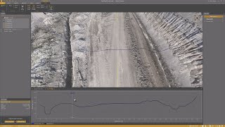
Virtual Surveyor offers advanced drone surveying software designed to improve efficiency in topographic surveying, mining, construction earthworks, and stockpile inventory management.
Features like the Terrain Creator and Virtual Surveyor apps, users can seamlessly transform drone data into actionable insights, ensuring precise reporting and streamlined workflows.
Virtual Surveyor را میتوان در موارد زیر یافت: Real Estate Virtual Tour & 3D Mapping دسته بندی ها.
شبیهترین محصولات به Virtual Surveyor عبارتند از:
اسکرینشاتها
هنوز هیچ اسکرینشاتی آپلود نشده است. آیا شما صاحب این کسب و کار هستید؟
اسکرینشاتها را آپلود کنید.ویدیوهای یوتیوب
ویدیوها از کانال رسمی یوتیوب
(20 videos)


![Balancing Cut and Fill [in PEAK]](https://i.ytimg.com/vi/bfoh-Lw3f5k/mqdefault.jpg)


![Planimetric Surveying [Fast and Simple]](https://i.ytimg.com/vi/bYudnDPf1d0/mqdefault.jpg)
![From Drone Photos to Topographic Surveys [EASY]](https://i.ytimg.com/vi/C4iywCyrctY/mqdefault.jpg)
![Contour lines at bare earth [with Zenmuse L1]](https://i.ytimg.com/vi/ClTtmWF45vY/mqdefault.jpg)
![Stockpile Inventory [with DRONES]](https://i.ytimg.com/vi/JTwOeov5AGI/mqdefault.jpg)
![Surveying curb and gutter [with DRONES]](https://i.ytimg.com/vi/8BEKcYrSnhc/mqdefault.jpg)
![Construction Site Earthworks Monitoring [DIRT]](https://i.ytimg.com/vi/j_R4xs7jJHI/mqdefault.jpg)


جزئیات
LinkedIn:
بازدید
YouTube:
بازدید
Instagram:
بازدید
سال تأسیس:
2015
قیمتگذاری:
€0-€21/mo
نوع مصرف کننده:
B2B
نقد و بررسیها
–
0 نقد و بررسیها
5
–
4
–
3
–
2
–
1
–
Virtual Surveyor ویژگیهای اصلی
X___0 مزایا
چه کسی باید از Virtual Surveyor استفاده کند؟
نشانها
با یکی از نشانهای ما، اعتبار SaaS خود را افزایش دهید
Virtual Surveyor جایگزین
Viralsweep تبلیغ شده
Viralsweep is a comprehensive viral marketing platform designed to create and...
Pythagoras
This software suite provides comprehensive tools for surveying, mapping, cons...
Drone Surveying
Drone Surveying offers precise aerial surveys for the house building sector, ...
PocketSurvey
Discover innovative building surveying software and mobile apps designed to e...
Civil Tracker
Civil Tracker offers innovative drone mapping software designed to simplify m...
Seiler GeoDrones
This platform offers comprehensive drone solutions, including advanced aerial...
ESurveying Softech
ESurveying Softech offers a range of online tools for infrastructural enginee...
3Dsurvey
This comprehensive software solution specializes in photogrammetry, mapping, ...
Carlson
This comprehensive land surveying and civil engineering software suite offers...
کاوش بیشتر در این دسته بندی:
فناوریهای مورد استفاده
html5shiv
Lightbox2
reCAPTCHA
Freshdesk
Awesome Font
Google Fonts
Google Tag Manager
Animate.css
Freshchat (Freshdesk Messaging)
FontAwesome
CDNJS
CookieConsent by Osano
ASP.NET
Ruby on Rails
HTML5
Wistia
Cloudflare
Wix Content Delivery Network (CDN)
برنامه همکاری در فروش
برنامه همکاری در فروش:
به برنامه همکاری در فروش بپیوندید
* گوگل تلاش میکند تا اطلاعات دقیق و بهروزی در مورد منابع وب ناامن ارائه دهد، اما نمیتواند کامل بودن یا بدون خطا بودن نتایج را تضمین کند.
** ممکن است برخی یا تمام بخشهای این صفحه توسط هوش مصنوعی تولید شده باشند، بنابراین لطفاً هرگونه اطلاعات مهم را بهطور مستقل تأیید کنید.
اخیراً ادعا شده است
نرمافزار بازخورد و نظرسنجی مشتری
ابزارهای مدیریت اسناد و امضای الکترونیکی
پردازش اسناد با هوش مصنوعی
پلتفرمهای تجارت اجتماعی
آمادگی برای صدور گواهینامه، آزمون و ارزیابی
مانیتورینگ، آپتایم و عملکرد وبسایت
ابزارهای اطلاعرسانی ایمیلی و ایمیلهای سرد
نرمافزار حضور و غیاب
نرمافزار حسابداری
نرمافزار ردیابی زمان و بهرهوری
اخیراً اضافه شده است
Orange Ops
ابزارهای امنیت و انطباق ابری
Aureon
پلتفرمهای AutoML
Plan with Blocks
نرمافزار مدیریت پروژه
PlantPilot
برنامهریزی منابع سازمانی
Baze
سیستمهای فروشگاهی و مدیریت رستوران
PassDMARC
امنیت ایمیل و ضد فیشینگ
SewDigital
نرمافزار مدیریت پذیرایی
Dazzle
پلتفرمهای تعامل فروش
nixcrip
برنامهریزی منابع سازمانی
Applipress
پلتفرمهای توسعه کم کد
10 دسته برتر این ماه
1.
پلتفرمهای معاملات سهام و کارگزاری
+759
تعداد محصولات جدید SaaS که در 30 روز گذشته به این دسته اضافه شدهاند.
2.
اتوماسیون گردش کار و RPA
+598
تعداد محصولات جدید SaaS که در 30 روز گذشته به این دسته اضافه شدهاند.
3.
ابزارهای غربالگری رزومه مبتنی بر هوش مصنوعی
+385
تعداد محصولات جدید SaaS که در 30 روز گذشته به این دسته اضافه شدهاند.
4.
نرمافزار اتوماسیون فروش
+339
تعداد محصولات جدید SaaS که در 30 روز گذشته به این دسته اضافه شدهاند.
5.
پلتفرمهای AutoML
+335
تعداد محصولات جدید SaaS که در 30 روز گذشته به این دسته اضافه شدهاند.
6.
نرمافزار مدیریت مدرسه
+299
تعداد محصولات جدید SaaS که در 30 روز گذشته به این دسته اضافه شدهاند.
7.
ابزارهای برنامهریزی و بودجهبندی مالی
+286
تعداد محصولات جدید SaaS که در 30 روز گذشته به این دسته اضافه شدهاند.
8.
ردیابی سلامت و تناسب اندام
+263
تعداد محصولات جدید SaaS که در 30 روز گذشته به این دسته اضافه شدهاند.
9.
آواتارهای مجازی و دستیاران دیجیتال مجهز به هوش مصنوعی
+262
تعداد محصولات جدید SaaS که در 30 روز گذشته به این دسته اضافه شدهاند.
10.
ابزارهای ویرایش و تبدیل PDF
+249
تعداد محصولات جدید SaaS که در 30 روز گذشته به این دسته اضافه شدهاند.
آمار مرورگر SaaS
اضافه شده در 30 روز گذشته
+23,810
تعداد محصولات جدید SaaS که در 30 روز گذشته کشف و به پایگاه داده ما اضافه شدهاند.
SaaS فعال
463,858
تعداد کل محصولات SaaS منتشر شده و فعال که در حال حاضر در موتور جستجوی ما فهرست بندی شده اند.
مجموع در پایگاه داده
1,309,358
تعداد کل محصولات SaaS موجود در پایگاه داده ما، شامل موارد منتشر نشده و متوقف شده.
به صورت رایگان به مرورگر SaaS بپیوندید
از تمام فیلترهای پیشرفته به صورت رایگان استفاده کنید
فهرستهای SaaS خود را مدیریت کنید
ایجاد هشدارهای رایگان برای SaaS جدید
حمایتشده
Snov
نرمافزار اتوماسیون فروش
Draftbit
سازندگان اپلیکیشن بدون کد با هوش مصنوعی
Keyword.com
هوش تجاری و تحلیل کسب و کار
ClearCRM
مدیریت ارتباط با مشتری (CRM)
Serpple
ابزارهای تحقیق کلمات کلیدی
Buffer
مدیریت و برنامهریزی رسانههای اجتماعی
Contractor Foreman
ابزارهای مدیریت پروژه ساختمانی
RankIQ
ابزارهای سئو
ReciPal
تغذیه و برنامهریزی رژیم غذایی به صورت SaaS
FinalScout
ابزارهای اطلاعرسانی ایمیلی و ایمیلهای سرد
از دست ندهید، اولین نفری باشید که مطلع میشود!
محصولات جدید SaaS هر روز عرضه میشوند، 23,810 فقط در 30 روز گذشته اضافه شده است. آگاه باشید و اولین نفری باشید که از کشف SaaS جدید مطابق با عبارت جستجوی شما توسط مرورگر SaaS مطلع میشود.
برای تنظیم هشدارهای ایمیلی برای SaaS جدید مطابق با جستجوی خود وارد شوید.
برای ایجاد هشدار وارد شوید
ابزارهای مشابه را بررسی کنید
مرور همه →