Maison › Toutes les catégories › Plateforme de cartographie et d'information géographique (SIG) › VEERUM
Obtenez une vérification et mettez à jour votre profil
Les profils revendiqués apparaissent en haut des résultats de recherche. Faites-vous vérifier dès maintenant, cela ne prend que quelques minutes.
Visite
Rapport
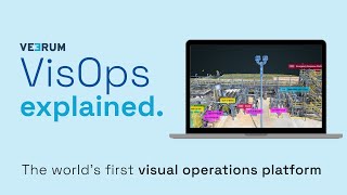
A visual operations platform facilitates the management and collaboration of industrial data by transforming it into an interactive 3D environment, enabling teams to visualize and analyze asset information remotely. Key features include real-time collaboration, geolocation of visual data, and integration with various data sets, addressing challenges such as reducing site visits, enhancing decision-making accuracy, and improving project alignment for industries like oil and gas, mining, and construction.
VEERUM se trouve dans Mapping & Geographic Information Platform (GIS) catégories.
Les produits les plus similaires à VEERUM sont :
Captures d'écran
Aucune capture d'écran n'a encore été téléchargée. Êtes-vous propriétaire de cette entreprise ?
Télécharger des captures d'écran.Vidéos YouTube
Vidéos de la chaîne YouTube officielle
(20 videos)


Détails
LinkedIn:
Visite
YouTube:
Visite
Facebook:
Visite
X:
Visite
Année de création:
2014
Tarification:
$0/mo
Type de consommateur:
B2B
Principales caractéristiques de VEERUM
Avantages VEERUM
Qui devrait utiliser VEERUM ?
Insignes
Augmentez votre autorité SaaS avec l'un de nos badges
Alternatives à VEERUM
Taskade Promu
A comprehensive digital platform designed to facilitate the creation, automat...
Aetos
This platform enhances operational efficiency by providing a comprehensive vi...
Optelos
The Visual Inspection Data Management Platform leverages Computer Vision AI t...
Hopara
This platform enables you to build a digital representation of your operation...
Flow Immersive
This innovative platform transforms complex datasets into immersive, interact...
Eye-bot
A remote asset visualization platform blends autonomous drone flights, 3D sca...
Birdi
A collaborative geospatial platform enables teams to seamlessly manage, visua...
Explorez davantage cette catégorie:
Technologies utilisées
Matomo
Awesome Font
WordPress REST API
Gravity Forms
Google Tag Manager
Cloudways
CDNJS
Tailwind
Hubspot
Cookiebot
HTML5
WordPress
Wistia
Cloudflare
Wix Content Delivery Network (CDN)
* Google s'efforce de fournir des informations précises et à jour sur les ressources Web non sécurisées, mais ne peut garantir l'exhaustivité ou des résultats sans erreur.
** Certaines ou toutes les parties de cette page peuvent être générées par l'IA, veuillez donc vérifier toute information critique de manière indépendante.
Réclamations récentes
Plateformes API et backend en tant que service
Outils de sélection de CV basés sur l'IA
Gestion des achats et des fournisseurs
Outils de référencement
Gestion d'atelier de réparation
Surveillance du site web, disponibilité et performances
Plateformes de marketing de contenu
Gestion d'atelier de réparation
Gestion des performances et évaluations des employés
Salle de sport, exercice et remise en forme
Ajouts récents
FitForge
Planification des patients et CRM pour les cliniques
LeadBox
Logiciel de génération de leads
Escalona
Automatisation des flux de travail et RPA
Venzallo
Logiciel de planification de rendez-vous
Bistroo
Commande et livraison de repas en ligne
Influbee
Outils de montage vidéo et d'animation basés sur l'IA
Spin4Fortune
Créations publicitaires et génération de vidéos alimentées par l'IA
Kito360
Planification des ressources de l'entreprise
FREE PDF Helper
Outils d'édition et de conversion de PDF
LevelCheck
Outils de sélection de CV basés sur l'IA
Les 10 catégories les plus populaires ce mois-ci
1.
Logiciel d'automatisation des ventes
+856
Nombre de nouveaux produits SaaS ajoutés à cette catégorie au cours des 30 derniers jours.
2.
Plateformes de gestion Blockchain et NFT
+592
Nombre de nouveaux produits SaaS ajoutés à cette catégorie au cours des 30 derniers jours.
3.
Outils de gestion de documents et de signature électronique
+522
Nombre de nouveaux produits SaaS ajoutés à cette catégorie au cours des 30 derniers jours.
4.
Avatars virtuels et assistants numériques alimentés par l'IA
+497
Nombre de nouveaux produits SaaS ajoutés à cette catégorie au cours des 30 derniers jours.
5.
Outils de sécurité et de conformité du cloud
+493
Nombre de nouveaux produits SaaS ajoutés à cette catégorie au cours des 30 derniers jours.
6.
Outils de sélection de CV basés sur l'IA
+489
Nombre de nouveaux produits SaaS ajoutés à cette catégorie au cours des 30 derniers jours.
7.
Diagnostic et analyse des soins de santé basés sur l'IA
+445
Nombre de nouveaux produits SaaS ajoutés à cette catégorie au cours des 30 derniers jours.
8.
Plateformes de recherche juridique alimentées par l'IA
+433
Nombre de nouveaux produits SaaS ajoutés à cette catégorie au cours des 30 derniers jours.
9.
Plateformes d'apprentissage et d'éducation
+426
Nombre de nouveaux produits SaaS ajoutés à cette catégorie au cours des 30 derniers jours.
10.
Logiciel de gestion de flotte
+422
Nombre de nouveaux produits SaaS ajoutés à cette catégorie au cours des 30 derniers jours.
Statistiques des navigateurs SaaS
Ajouté au cours des 30 derniers jours
+21,811
Nombre de nouveaux produits SaaS découverts et ajoutés à notre base de données au cours des 30 derniers jours.
SaaS actif
468,001
Nombre total de produits SaaS publiés et actifs actuellement indexés dans notre moteur de recherche.
Total dans la base de données
1,296,182
Nombre total de produits SaaS dans notre base de données, y compris les entrées non publiées et abandonnées.
Inscrivez-vous gratuitement à SaaS Browser
Utilisez gratuitement tous les filtres avancés.
Gérez vos annonces SaaS
Créez des alertes gratuites pour les nouveaux SaaS
Sponsorisé
LowFruits
Outils de référencement
Uxcel
Préparation à la certification, aux examens et aux évaluations
Clockify
Logiciel de suivi du temps et de productivité
Click Analytic
Outils de marketing d'influence et de sensibilisation
Intellivy
Plateformes de recherche juridique alimentées par l'IA
APITemplate
Traitement de documents alimenté par l'IA
AnswerThis
Outils académiques
Buffer
Gestion et planification des médias sociaux
Diginius
Plateformes d'automatisation du marketing
DashThis
Logiciel d'analyse et de visualisation de données
Ne ratez pas cette occasion, soyez le premier informé !
De nouveaux produits SaaS sont lancés chaque jour ; 21,811 ont été ajoutés au cours des 30 derniers jours. Restez informé et soyez parmi les premiers à savoir quand SaaS Browser détecte un nouveau SaaS correspondant à votre recherche.
Connectez-vous pour configurer des alertes e-mail pour les nouveaux SaaS correspondant à votre recherche.
Se connecter pour créer une alerte
Explorer des outils similaires
Tout parcourir →