Qinisekisa futhi Ubuyekeze Iphrofayela
Amaphrofayili afuniwe aya phezulu emiphumeleni yosesho. Qinisekisa manje, kuthatha imizuzu embalwa nje.
Vakashela
Bika
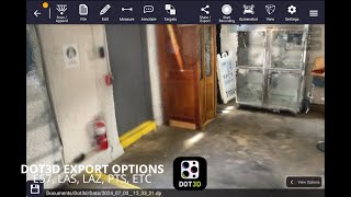
This three-dimensional scanning application provides precise control over accuracy, enabling detailed and extensive capture of large-scale scenes such as buildings, roadways, and infrastructure. Its key features include automatic optimization algorithms for post-processing, seamless integration with high-precision GNSS devices for geo-referencing, support for adding coded targets and reference measurements to improve accuracy, and the ability to handle virtually unlimited scene sizes with rapid local processing and compatibility with desktop data editing—making it ideal for professionals in architecture, surveying, construction, and engineering seeking efficient, reliable, and scalable 3D data acquisition and analysis.
Dot3D ingatholakala ku Architectural Design & Drafting Software izigaba.
Imikhiqizo efana kakhulu ne-Dot3D yile:
Izithombe-skrini
Azikho izithombe-skrini ezilayishiwe okwamanje. Ingabe ungumnikazi waleli bhizinisi?
Layisha izithombe-skrini.Amavidiyo e-YouTube
Amavidiyo avela esiteshini esisemthethweni se-YouTube
(2 videos)

Imininingwane
LinkedIn:
Vakashela
YouTube:
Vakashela
Facebook:
Vakashela
X:
Vakashela
Instagram:
Vakashela
Unyaka Omisiwe:
2012
Intengo:
$0-$999/mo
Uhlobo Lomthengi:
B2B
Izibuyekezo
–
0 izibuyekezo
5
–
4
–
3
–
2
–
1
–
Dot3D Izici Eziyinhloko
Amabheji
Khulisa igunya lakho le-SaaS ngelinye lamabheji ethu
Dot3D Okunye
Contractor Foreman Kukhuthazwe
This comprehensive construction management platform streamlines the coordinat...
Pythagoras
This software suite provides comprehensive tools for surveying, mapping, cons...
3Dsurvey
This comprehensive software solution specializes in photogrammetry, mapping, ...
Carlson
This comprehensive land surveying and civil engineering software suite offers...
NUBIGON
This software facilitates the visualization, analysis, and presentation of co...
Undet
This software suite offers advanced tools for converting, visualizing, and an...
Ajile
This advanced 3D imaging and measurement system leverages high-resolution, fu...
RecFusion
This system enables real-time 3D digitization and modeling using RGB-D sensor...
SkyeBrowse
This innovative software transforms video footage into detailed 3D models, en...
Hlola okwengeziwe kulesi sigaba:
Ubuchwepheshe obusetshenzisiwe
Squarespace
reCAPTCHA
MailChimp
Zoho
Adobe Fonts
Google Tag Manager
Tailwind
HTML5
Angular
WordPress
Wix Content Delivery Network (CDN)
Uhlelo Lokubambisana
Uhlelo Lokubambisana:
Joyina Uhlelo Lokubambisana
* I-Google izama ukunikeza ulwazi olunembile, olusesikhathini samanje ezinsizeni zewebhu ezingaphephile kodwa ayikwazi ukuqinisekisa ukuphelela noma imiphumela engenamaphutha.
** Ezinye noma zonke izingxenye zaleli khasi zingase zenziwe i-AI, ngakho-ke sicela uqinisekise noma yiluphi ulwazi olubalulekile ngokuzimela.
Okusanda Kufunwa
Sales Automation Software
Amathuluzi Okusebenzisana Kwethimba Elikude
Ukuhlaziywa Kwedatha Nesoftware Yokubona
Izinkundla Zokufunda Nezemfundo
I-Payroll Management Software
I-Project Management Software
Amapulatifomu Okuhweba Ngezitoko Nokuhweba
Accounting Software
Amathuluzi Okuhlelwa Kwezimali Nesabelomali
I-CRM Ethengiswayo Nokuphathwa Kokuhola
Okungeziwe Muva nje
Press Monkey
I-Influencer Marketing & Outreach Tools
Video Fleet Solutions
I-Fleet Management Software
VEP
Ukuzenzakalela Komsebenzi kanye ne-RPA
MenuLogic
I-Nutrition & Diet Planning SaaS
CryptoChat
Isofthiwe Yokubethela
CogSeven Companion
Amanothi nama-Platform eSayensi Yedatha
TaskAcross
Ukuphathwa Kwemisebenzi Nohlu Lwezinhlelo Zokusebenza
AnchorPoint Logics
Isofthiwe Yokunakekelwa Kwempilo Yasekhaya
PainCanvas
Ukulandelela Impilo Nokufaneleka
BatchGrid
Isofthiwe Yokuphatha Ukuphepha Ne-EHS
Izigaba Eziyi-10 Eziphezulu Kule Nyanga
1.
Sales Automation Software
+856
Inani lemikhiqizo emisha ye-SaaS engezwe kulesi sigaba ezinsukwini ezingu-30 ezedlule.
2.
Blockchain & NFT Management Platforms
+592
Inani lemikhiqizo emisha ye-SaaS engezwe kulesi sigaba ezinsukwini ezingu-30 ezedlule.
3.
Amathuluzi Okuphatha Amadokhumenti Namathuluzi e-eSignature
+522
Inani lemikhiqizo emisha ye-SaaS engezwe kulesi sigaba ezinsukwini ezingu-30 ezedlule.
4.
Ama-avatar abonakalayo anikwe amandla yi-AI nabasizi Bedijithali
+497
Inani lemikhiqizo emisha ye-SaaS engezwe kulesi sigaba ezinsukwini ezingu-30 ezedlule.
5.
Ukuphepha Kwamafu Namathuluzi Okuthobela
+493
Inani lemikhiqizo emisha ye-SaaS engezwe kulesi sigaba ezinsukwini ezingu-30 ezedlule.
6.
Amathuluzi Okuhlola Kabusha anikwe amandla yi-AI
+489
Inani lemikhiqizo emisha ye-SaaS engezwe kulesi sigaba ezinsukwini ezingu-30 ezedlule.
7.
I-AI-powered Diagnosis & Healthcare Analytics
+445
Inani lemikhiqizo emisha ye-SaaS engezwe kulesi sigaba ezinsukwini ezingu-30 ezedlule.
8.
Amapulatifomu ocwaningo lwezomthetho anikwe amandla yi-AI
+433
Inani lemikhiqizo emisha ye-SaaS engezwe kulesi sigaba ezinsukwini ezingu-30 ezedlule.
9.
Izinkundla Zokufunda Nezemfundo
+426
Inani lemikhiqizo emisha ye-SaaS engezwe kulesi sigaba ezinsukwini ezingu-30 ezedlule.
10.
I-Fleet Management Software
+422
Inani lemikhiqizo emisha ye-SaaS engezwe kulesi sigaba ezinsukwini ezingu-30 ezedlule.
Izibalo Zesiphequluli se-SaaS
Kungezwe Ezinsukwini Ezingama-30 Ezidlule
+21,811
Inani lemikhiqizo emisha ye-SaaS etholakele futhi engezwe kusizindalwazi sethu ezinsukwini ezingu-30 ezedlule.
I-SaaS esebenzayo
468,001
Inani eliphelele lemikhiqizo ye-SaaS eshicilelwe nesebenzayo okwamanje ekhonjiswe enjini yethu yokusesha.
Isamba Esikusizindalwazi
1,296,182
Inani eliphelele layo yonke imikhiqizo ye-SaaS kusizindalwazi sethu, kufaka phakathi okufakiwe okungashicilelwanga kanye nokungasasebenzi.
Joyina isiphequluli se-SaaS Mahhala
Sebenzisa zonke izihlungi ezithuthukisiwe mahhala
Phatha uhlu lwakho lwe-SaaS
Dala izexwayiso zamahhala ze-SaaS entsha
Kuxhasiwe
Viralsweep
I-SMS & Amathuluzi Okuthengisa E-WhatsApp
Singing Carrots
Izinhlelo zokusebenza zokufunda ulimi ezinikwe amandla yi-AI
Strikingly
Abakhi Bewebhusayithi
Keyword.com
Business Intelligence & Analytics
Oh Dear
Ukuqapha Iwebhusayithi, Isikhathi Sokusebenza Nokusebenza
EmployTest
Amathuluzi Okuhlola Kabusha anikwe amandla yi-AI
Signaturely
Amathuluzi Okuphatha Amadokhumenti Namathuluzi e-eSignature
plusvibe
Ukufinyelela I-imeyili Namathuluzi Okuthumela I-imeyili Okubandayo
Mailtrap
Marketing Automation Platforms
ReciPal
I-Nutrition & Diet Planning SaaS
Ungaphuthelwa, yiba ngowokuqala ukwazi!
Imikhiqizo emisha ye-SaaS iyasungulwa nsuku zonke, i-21,811 ingeziwe ezinsukwini ezingu-30 ezedlule kuphela. Hlala unolwazi, futhi ube ngowokuqala ukwazi ukuthi i-SaaS entsha ehambisana nombuzo wakho wokusesha itholakala nini yi-SaaS Browser.
Ngena ngemvume ukuze usethe izexwayiso ze-imeyili ze-SaaS entsha ehambelana nokusesha kwakho.
Ngena Ngemvume Ukuze Udale Isexwayiso
Hlola amathuluzi afanayo
Phequlula konke →